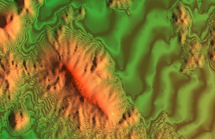
One of digital-elevation-maps issued by Japan Geographical Institute is converted to triangular polygons with our software.
[Sample Image] Back to Index
NfDesign paints color-gradation on it and also generates contours(10m) by zebra-mapping.